State Authority for Geospatial Information, as the public authority responsible for the topic: “Determination of the geodetic reference frame and geodetic control”, has published on the National Geoportal the geospatial information for the layer “State Leveling Network”.
State Leveling Network is one of the constituent networks of the Geodetic Reference Framework of Albania (GRE). This network will enable the control and assessment of the accuracy of the gravimetric geoid on which the new vertical geodetic reference will be based for the determination of orthometric heights in the territory of the Republic of Albania.
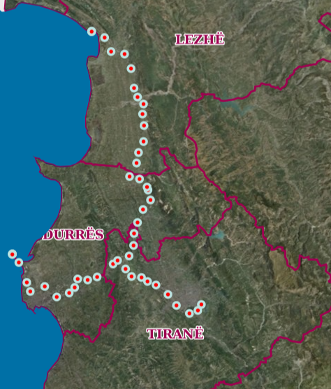
This network is currently designed in two tiers, for the first tier of this network, 2 leveling lines with a total length of 125.24 km have been built, which are Tirana-Durrës with a length of 58.75 km (26 benchmarks) and Vorë-Shëngjin with a length of 66.49 km (25 benchmarks).
The published data for this layer are in accordance with the state standard for technical specifications of geospatial information in Albania. Topic: “Determination of the geodetic reference frame and geodetic control”.
.