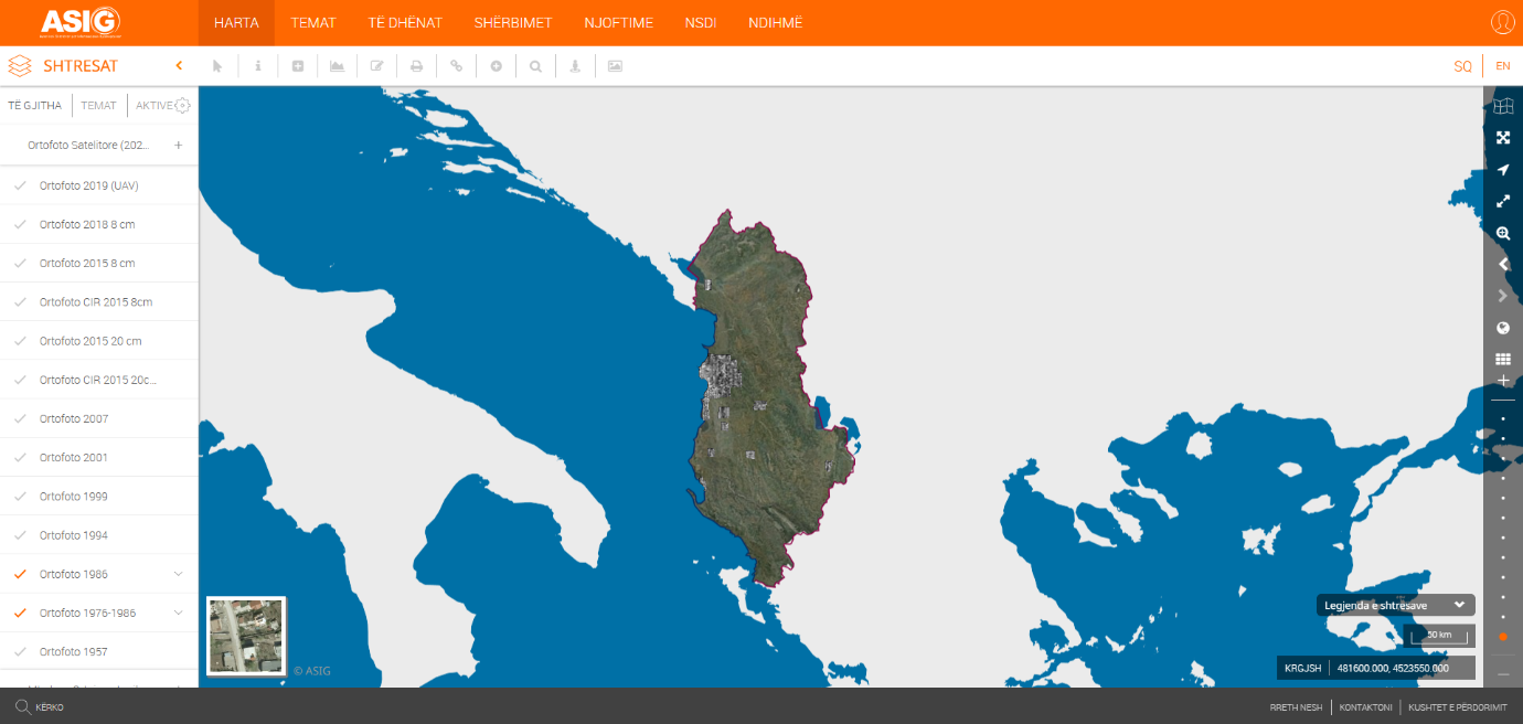
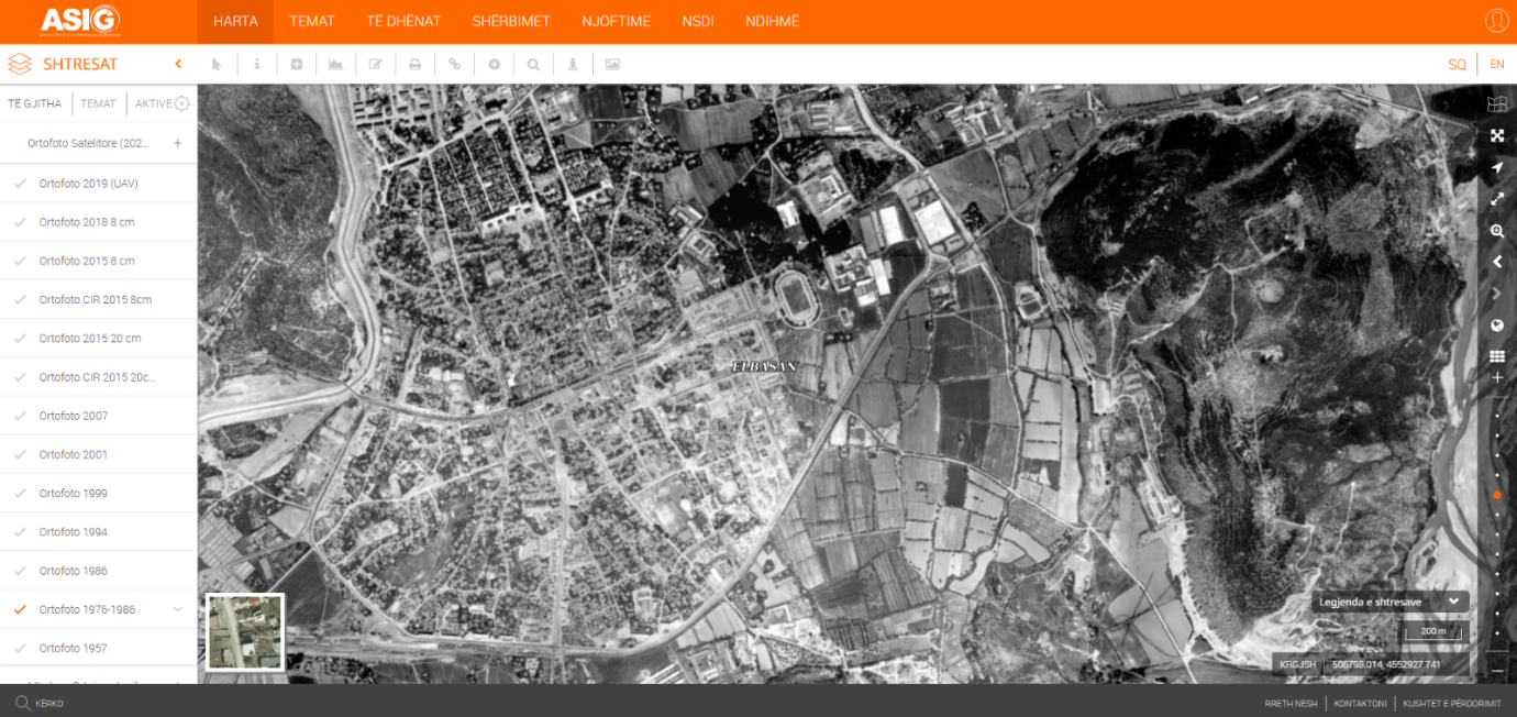
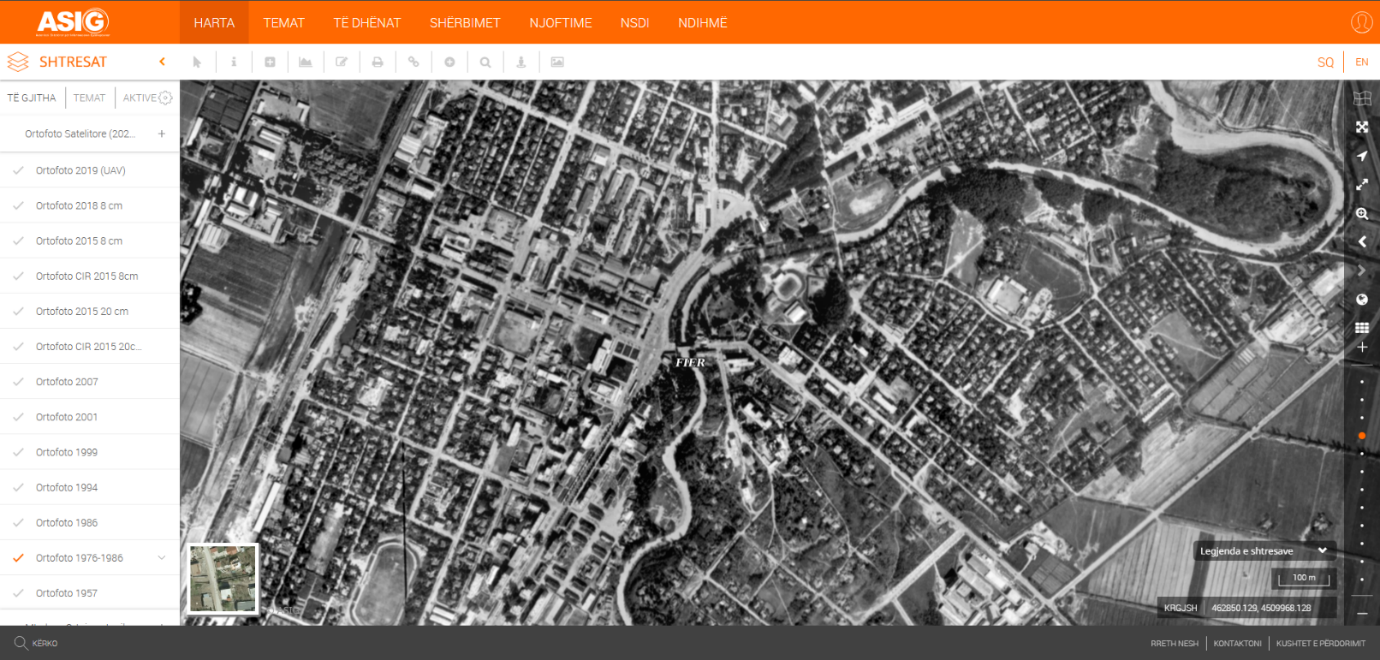
State Authority for Geospatial Information, in its role as the public authority responsible for the topic “Orthoimaging”, has produced and published on the National Geoportal geospatial information for the layer “Orthophoto 1976-1986”.
This orthophoto produced from photographs taken in the period 1976-1986, covers 16 cities in Albania and their surroundings, with a coverage area of 1911 km². The cities covered are: Tirana, Durrës, Vlorë, Shkodër, Elbasan, Korçë, Berat, Fier, Kavajë, Lushnje, Rrogozhinë, Shijak, Peqin, Kamëz, Fushë Krujë and Manëz.
The orthophoto was produced in GEOTIFF format, in the Geodetic Reference System, (KRGJSH), based on the provisions of the Decision of the Council of Ministers no. 669, dated 07.08.2013, as amended. The orthophoto product is in panchromatic format (black and white) and was obtained from scanned images of aerial photographs taken from the Archives of the Institute of Geography and Cartography of the Army (IGJIU).
The data are in conformity with the standard with the Council of Ministers No. 397, dated 19.06.2019, for the approval of the document "State Standards for Technical Specifications of Geospatial Information in Albania - Topic: Orthoimagery".
This product comes to the aid of all institutions dealing with property management, such as the State Cadastre Agency (ASHK), the Property Management Agency (ATP) and local governments in terms of handling AMTPs (Acts of Land Acquisition) and resolving property conflicts